posted by Jeremy @ 10:58 AM
2 comments
![]()
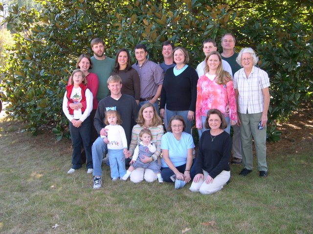
 Anna Claire provided the after-dinner entertainment.
 Mad and Lizzy
 Madeline has embraced her responsibilities as a role model for the younger girls by teaching them how to stick out their tongues at the camera.
posted by Jeremy @ 10:51 AM
0 comments
![]()
 Everytime we go to Alabama I want to take the shortcut through Little River Canyon. Dea always says "no," but she did allow me to stop at Little River Falls on the way down for Thanksgiving. Even thought the falls aren't huge they do mark the start of one of the deepest canyons in the eastern U.S.
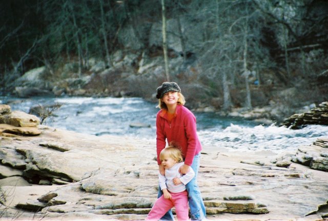 Molly really wanted to play in the water.
posted by Jeremy @ 10:44 AM
0 comments
![]()

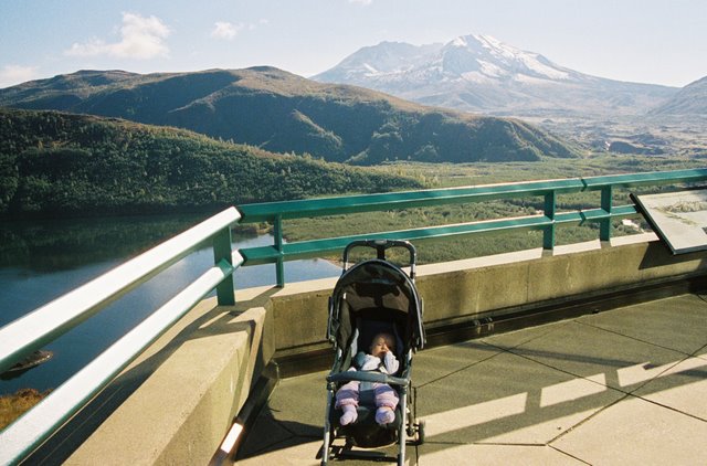
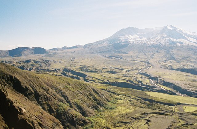
My first view of Mt. Saint Helens, looking up the Toutle River Valley.
 The explosion blew off the north face of the mountain, creating the largest landslide in recorded history. It also blew 1000' off the top, reducing the height from 9300' to 8365'. Mt. Saint Helens used to be a perfectly simmetrical volcano, like a minature Mt. Fuji, but now it is something of a deformed hulk; I think it is beautiful.
posted by Jeremy @ 10:06 AM
0 comments
![]()
 Emma at the Cold Water Ridge Visitor Center.
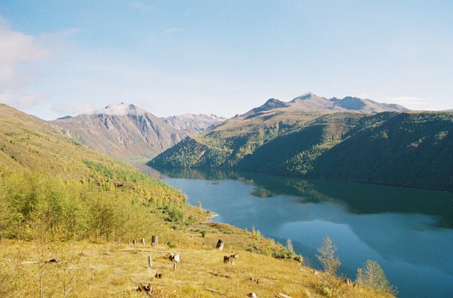 Cold Water Lake did not exist before the eruption. There was a creek that flowed through the valley, but the eruption dammed it and the lake was born. It is three miles long and upto 200' deep. There was some concern that this and other smaller lakes formed by the eruption would eventually burst their dams and flood the towns downstream so the Corps of Engineers have rigged outlets to keep the lakes from overflowing. So much for allowing nature to take its course...
 Close-up of the crater. Magma is continually adding to the lava dome. If the current rate of growth continues the mountain should be at its preblast height in one hundred years. To the left you can see America's newest glacier. It formed in the perpetual shadow of the lava dome.
posted by Jeremy @ 9:57 AM
0 comments
![]()
 This is the view from Johnson Ridge (named after a geologist who was killed in this spot during the eruption). You can see the collapsed north side of the crater. The debris from the landslide filled the valley to a depth of 600'. Nothing much grows there, so you can clearly see the canyons carved by streams off the mountain. It is possible to climb the south side of the mountain and glance into the crater from the rim. Madeline has agreed to hike it with me, even though you have to wear a helmet and carry glasses and a mask.
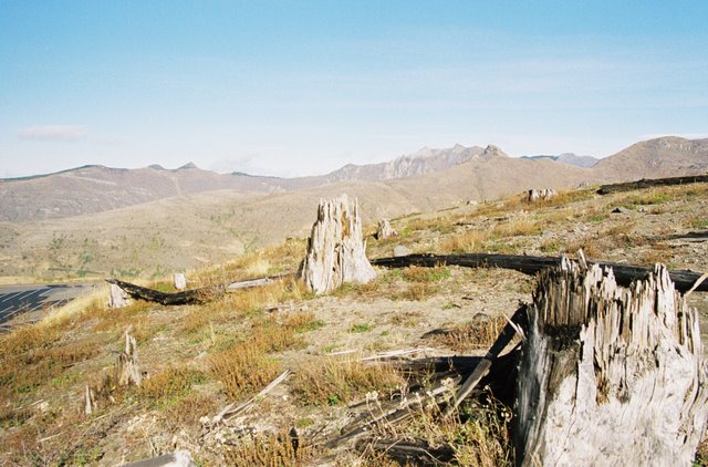 Trees completely covered the area before the eruption; large trees up to 8 feet in diameter. They were much larger than anything we have on the east coast.
 This is Emma's lunch spot. When she is older and complains we never take her anywhere, I can pull out this photo and tell her I took her to a volcano.
posted by Jeremy @ 9:44 AM
0 comments
![]()